ESTREITO DA CALHETA
(PARISH OF CALHETA MUNICIPALITY)
32° 44' 11" N 17° 11' 20" W
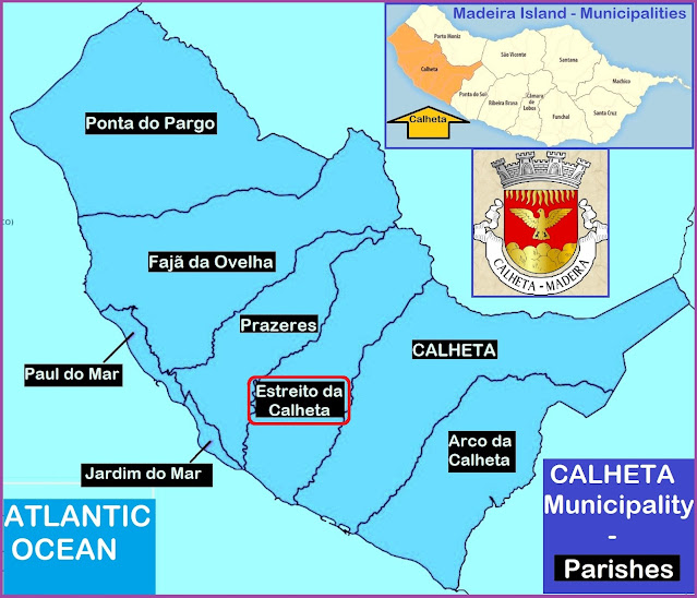
Estreito da Calheta is a Portuguese parish in the municipality of Calheta, with an area of 13.4 km² and 1,607 inhabitants (2011). Its population density is 112.2 inhabitants/km². It is located at latitude 32.71667 (32°43') North and longitude 17.2 (17°12') West, at an altitude of 0 meters. Estreito da Calheta with a street that connects Calheta and Funchal. The area is made up of agriculture. It has a coast on the Atlantic Ocean to the south. There are mountains to the northeast.
History
The name of the parish of Estreito da Calheta originated from its orographic conditions, as it is characterized by a deep valley, similar in appearance to a gorge. According to some sources, settlement occurred at the beginning of the second half of the 16th century.
Among economic activities, agriculture stands out, with vineyards and sugar cane playing a fundamental role. Sugar was, for centuries, considered white gold and in other times it was exported in exchange for Flemish art today exhibited at the Museum of Sacred Art, in the city of Funchal.
The São Bartolomeu stream, to the east, divides the Estreito da Calheta from the Parish of Calheta, and the Ribeira Funda, to the west, divides it from the Parish of Prazeres.
In addition to the Rabaçal Levada, the Estreito da Calheta is irrigated by the Levada dos Moinhos, Levada Nova, Levada do Ribeiro do Farrobo, and Levada dos Ferreiros.
💓💓💓💓💓
SEARCH IN
CALHETA MUNICIPALITY
Calheta;
Arco da Calheta;
Estreito da Calheta;
Jardim do Mar;
Prazeres;
Paul do Mar,
Fajã da Ovelha;
Ponta do Pargo;
Return to mainland Portugal and
to the Azores and Madeira islands


No comments:
Post a Comment